Something strange in Antarctica, and frozen memories
Does anyone have an idea?
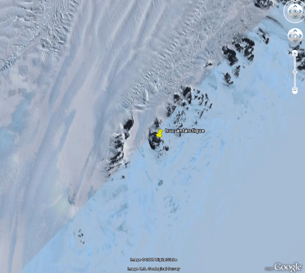
May 17–18, 2009
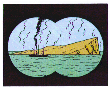
Shortly after Google Earth was launched, I had already pointed out how easily these images could be manipulated, and should be taken with caution—prone to making us mistake windbags for lanterns. Therefore, I don’t usually repost every oddity spotted by readers. That said, a few days ago, Mr. Ludovic Ferry drew my attention to a particularly strange photograph.
Google Earth link: http://eratest.free.fr/truc_antarctique.kmz
Google Maps link: http://maps.google.fr/maps?ll=-66.603462,99.720033&z=17&t=h&hl=fr
Here are the corresponding images, at different levels of zoom. Google Earth takes us to a point located along the edge of the Antarctic plate:

This is facing the South Atlantic:

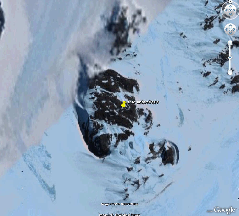
Getting closer:

Even closer, a strip of land becomes visible...
Let’s dive down onto this exposed strip of land...
And at maximum resolution, this appears:
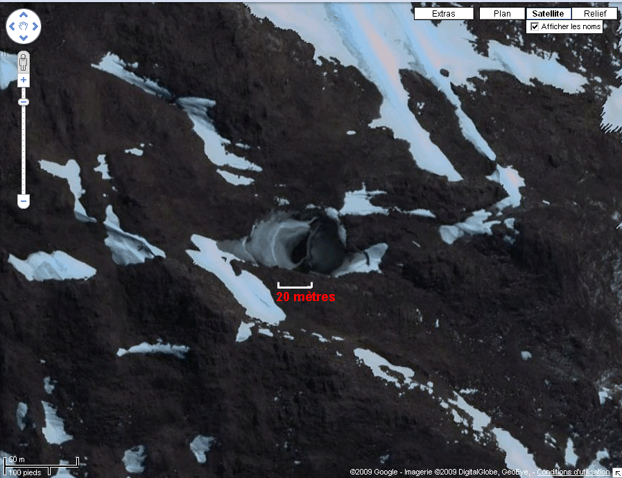
At the bottom left, we have the scale of this oddity: a few tens of meters. Let’s zoom in further:

I’ve drawn what a man standing on what appears to be a snowfield—a slab of ice covering land or rock—would look like. I drew this black vertical line myself!
May 18, 2009
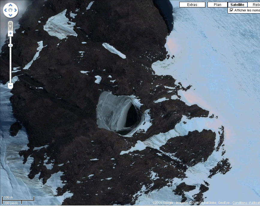
Frédéric Unternahr points out that there’s a similar formation to the northeast of this location. Google Earth combines satellite and aerial images, which are more detailed. This sometimes results in sharp regions juxtaposed with blurry ones. Here too, we’re south of a "blurry" area, where its edge is visible at the top left.
Once again, it resembles some kind of chasm, roughly seventy meters across at its widest point and forty to fifty meters at its narrowest. If anyone has an explanation, I’m all ears... Otherwise, I’ll just have to admit defeat.
A few decades ago, I traveled to Iceland with my son Jean-Christophe and the team of Maurice and Katia Kraft (who died, burned by a pyroclastic surge, along with 39 others on June 3, 1991, while observing the eruption of Mount Usen in Japan). There, I learned how to revive geysers by pouring a bottle of dish soap into their vents, which lowers the boiling point at the base of the column. I’ll take a brief detour here, unrelated to this photo. A geyser is a column of water in contact at its base with a heat source. Periodically, the boiling temperature is reached at the base of the water column. A vapor bubble forms and rises. On Wikipedia, you’ll see there are various types of geysers. I can only speak of those I’ve seen—those topped by small greenish lakes, tinted by algae thriving at high temperatures.
When the bubble bursts through the liquid surface, the water initially surges upward violently. A powerful geyser can lift the surface of the small lake by more than half a meter. Then, the top of this water hill bursts open, releasing steam vertically. All of this happens extremely quickly—within less than a second. When you revive a geyser with dish soap—a trick known and practiced by all volcanologists—the geyser emits hundreds of thousands of soap bubbles, creating an unforgettable spectacle.
We had traveled to Iceland after reading Jules Verne’s book Journey to the Center of the Earth. You may recall that in the story, the heroes find a manuscript they decode, written by Aarne Saknudsen (if my memory serves). The text reportedly said:
- Descend into the crater of Sneffels and you will reach the center of the Earth.
We descended into every crater we could find, without distinguishing the one mentioned in the book. I remember... so many things. A volcano whose cone was entirely made of obsidian blocks (black glass of stunning effect). This sharp, cutting material was used by Central American indigenous peoples—Aztecs and others—as weapons, glued to wooden swords with resin. These swords couldn’t withstand the steel blades of the conquistadors. I remember the green waters of the Laki crater, where we swam. A magnificent, giant hot spring pool where one couldn’t touch the bottom without burning their feet.
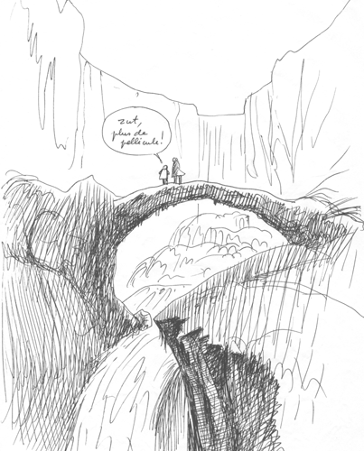
In Iceland, parts of the coast consist solely of compacted ash, sculpted by torrents at will:
Here’s a corner of a cliff, with puffins.
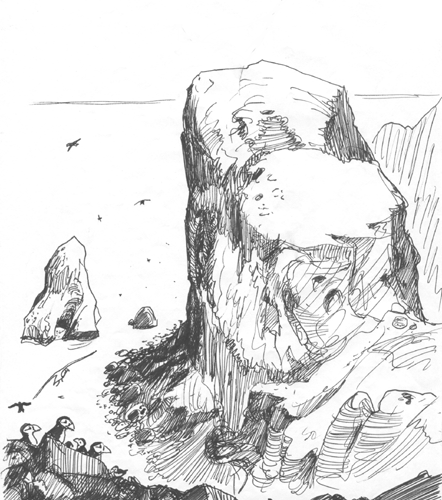
Puffins are seabirds the size of pigeons. They nest in burrows they easily dig here. They have a knife-like beak and a fairly long tongue, allowing them to store small fish between their tongue and the upper part of the beak. They can carry three or four at once and keep catching more. They are the pterodactyls of today, likely using their beaks in the same way—long rear crests acting as counterweights (not as rudders, as some paleontologists still believe, who’ve never flown a delta wing with a movable trailing edge).
We took a boat to the island of Heimaey, just over a year after the eruption of the volcano Helgafell in January 1973, which was considered “the prototype of an extinct volcano” by the professor of volcanology teaching in Reykjavik. He had said exactly that the day before the eruption (authentic). Here’s a sketch I made during the boat ride:
On our way to Heimaey Island
Memories come rushing back—such is the way it is. My pen wanders freely. I’ll eventually return to the main topic, I promise.
Here’s my map:
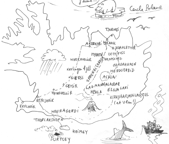
Notice the name of this place: Kirkjubæjarklaustur (pronounced in one breath)
Helgafell spewed ash and vomited lava, which began to clog the small harbor of the island. A true catastrophe for the residents, who had the highest per capita income in the world after Kuwaitis. Indeed, Heimaey is almost at the epicenter of one of the most fish-rich regions on Earth. The fishing boats from the island only needed to go out, circle the island, and return with their holds full, supplying the fishmeal factory.
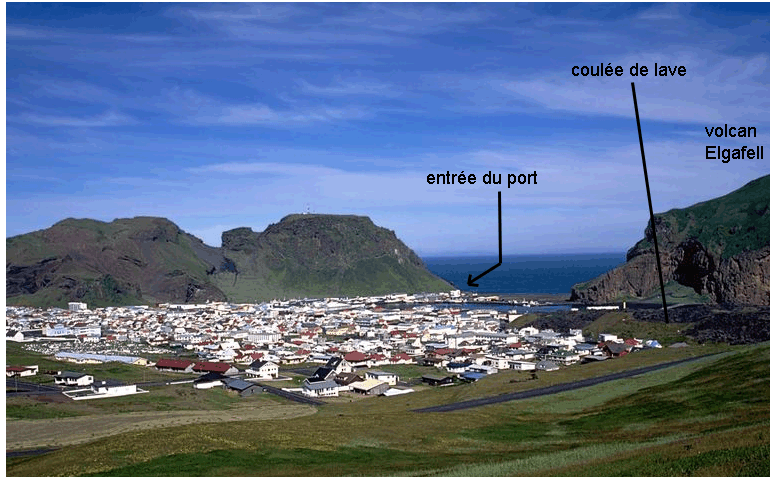
Heimaey Island. On the right: the lava flow from January 1973, which covered many houses
The eruption was not violent but continuous. In the photo, you can see the lava flow that covered 25% of the settlement, which had about 5,000 inhabitants at the time. There’s a house you can visit today—the owner had a magnificent view of the bay from his terrace before the eruption. The house is intact, but solidified lava now forms an opaque wall just fifty centimeters from its windows, which must have severely reduced its real estate value. There were a few rather comical episodes. The wealthy residents had rented a cargo ship to transport all their riches. There were many sports cars—Ford Mustangs—that islanders used on the island’s 4 km of road to buy cigarettes or visit friends. So they piled their wealth into the ship. Others chartered a twin-engine plane. Then, a heavy ash emission occurred. Aircraft wings aren’t designed to handle strong negative loads. These people didn’t have time to clear the wings, which bent down to the ground. As for the cargo ship, it sank in the harbor with its sports cars and color TVs.
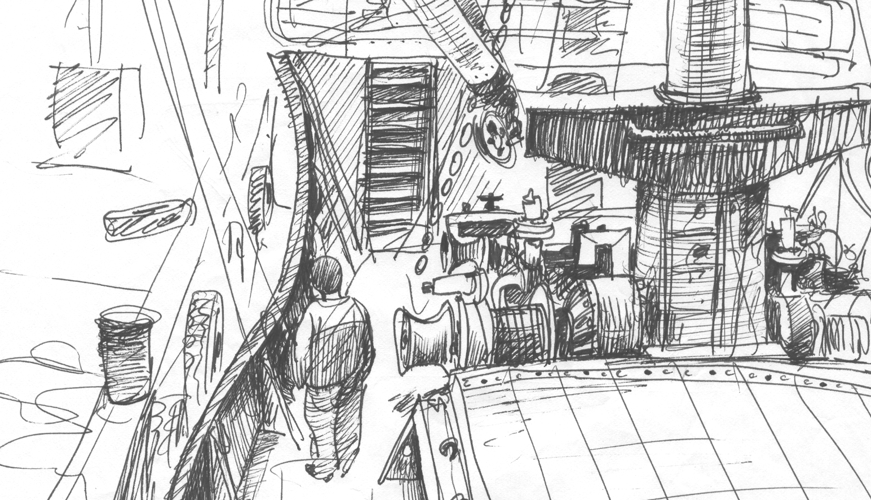
The people of Vestmannaeyjar, the town above, are extremely xenophobic. A true record. Usually, I manage to draw anywhere in the world. This time, I went to sketch at the fishing port. Below is a pen drawing (I say "pen," but it’s actually a ballpoint) of a magnificent trawler:
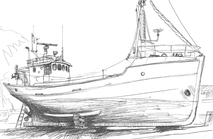
The owner shows up and asks me (in English) if I want to sell him the drawing. I replied:
- It’s your trawler—I understand that. Here’s my offer: I won’t sell you this drawing. I’ll give it to you as a gift. But in exchange, you buy me a coffee at your place.
The man paled, said my price would be his, that he could pay fifty or even a hundred dollars if needed… (the drawing was fairly good, I must admit).
But I held firm. Coffee at his house—or nothing. I could feel him boiling with anger. But he preferred to let the drawing of his boat go rather than allow a foreigner to cross his threshold (which would have likely embarrassed him among neighbors). So that’s the story behind this drawing—anything but ordinary. The only one who ever successfully infiltrated the local population was my son Jean-Christophe, then seven years old and blond as wheat. He managed to be invited into a local home for a tea party with other children. But kids that age aren’t xenophobic or racist. It’s the “adults” who teach them these nonsense later.
Back to the eruption story. The Icelanders had an idea: they asked a nearby American aircraft carrier to lend them bilge pumps, and using these, they began spraying seawater at high pressure onto the lava to cool it and make it more viscous. This reminds me of another story, years later. During some CNRS event, I found myself listening to a lecture by volcanologist Haroun Tazieff. May his soul rest in peace. If you search Haroun Tazieff on Wikipedia, you’ll see a stamp was issued in his name. I met him twice. The first time was in Belgium, where he had practiced rock climbing. I met him during a climb of the Chaleux Chimney, pictured here, if I’m not mistaken.
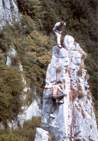
First on rope, on the Chaleux Chimney: my friend Jean Lecomte
The second time was during that CNRS lecture. He spoke about volcanology and laughed heartily while mocking the Icelanders who had hoped to slow their volcano’s lava flow by spraying seawater on it. Haroun, known for his loud voice, added with a smile stretching across his face:
- It was like kids peeing on lava. That’s exactly what I told them!
Indeed, that’s what he said. But the Icelanders, who are quick-thinking, didn’t hesitate. They put him on the first plane back and banned him from returning to their island. In fact, Tazieff was wrong. The seawater spraying did make the lava more viscous and the flows thicker. Thanks to this system, the residents of Vestmannaeyjar narrowly avoided their “solid gold” harbor being completely blocked. But if you look at the photos, it was a close call. I didn’t want to embarrass Tazieff publicly, thinking I already had enough enemies as it was—and certainly not in volcanology.
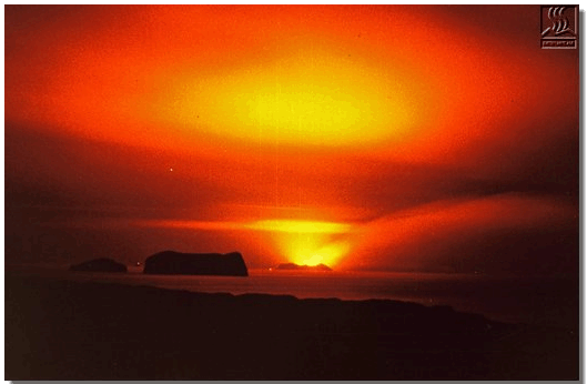
Ah, I have one more amusing anecdote to share about this southwestern part of the Atlantic near Iceland. On the map, you see—barely mentioned—the islet of Surtsey. It began on November 14, 1963, 18 km southwest of Heimaey Island:
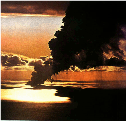
Before the emergence of the Surtsey islet: steam and gas
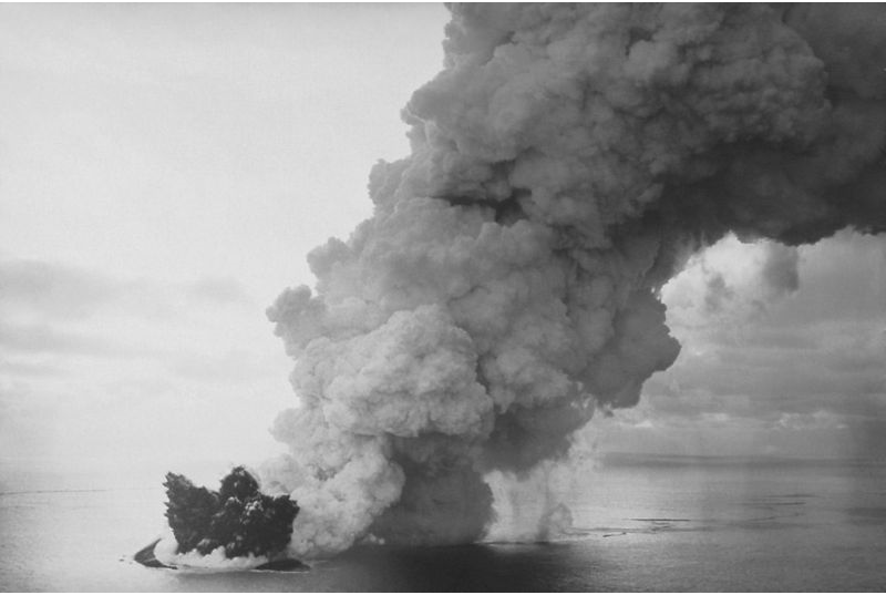
The summit of the submarine volcano emerging
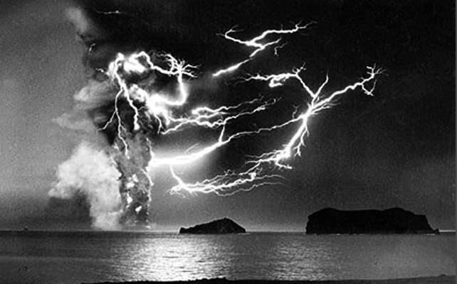
Volcanic plumes are sites of intense electrical activity
Dust particles become electrified as they whirl in the gases, creating potential differences of hundreds of millions of volts. In thunderclouds, tiny ice crystals become charged as they “fall” through hot air spirals. Same voltage differences, same effects. When these crystals become heavy enough, they escape the cloud and fall toward the ground. Since the temperature is higher, they turn into raindrops. Snowflakes or hailstones if the temperature remains below zero all the way to the ground. This gives a small idea of the electrical activity on early Earth, which led to the synthesis of amino acids (Stanley Miller’s experiment).
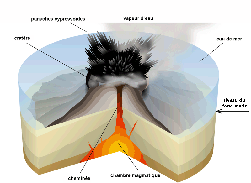
Diagram of this type of eruption
An island being born
Before the submarine eruption began, the seafloor was at 130 meters depth. But by the next day, an island had formed—just like in the Tintin comic The Mystery of the Unicorn.
Excerpt from The Mystery of the Unicorn, Tintin’s adventures
Surtsey erupting. Photo taken from Heimaey Island
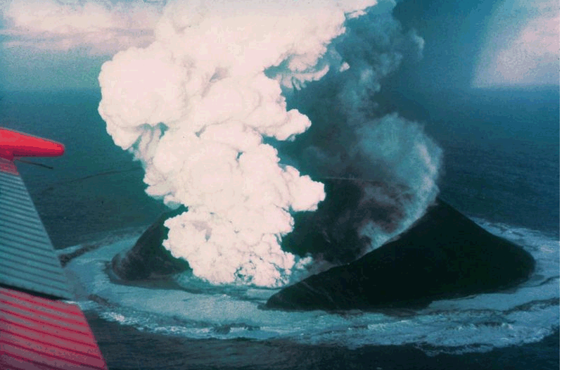
By late January, the island’s peak reached 174 meters—300 meters above the local seafloor. On April 4, 1964, five months after the island emerged, lava was emitted onto the surface:
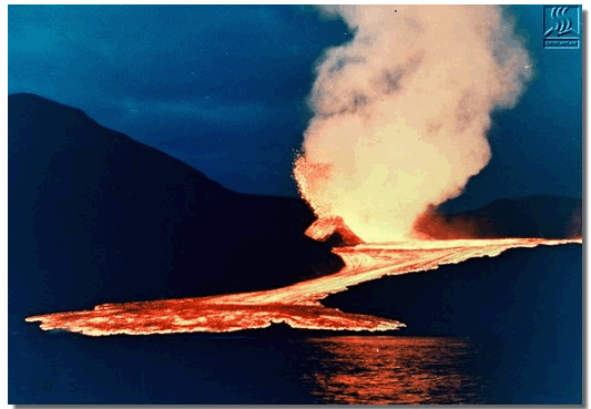
Surtsey: fluid lava flowing across the island’s surface
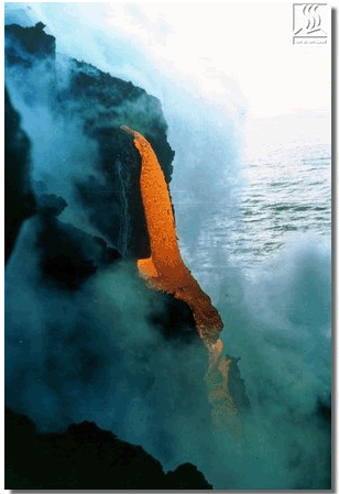
And into the sea
One of Surtsey’s eruptive vents
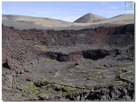
The western crater
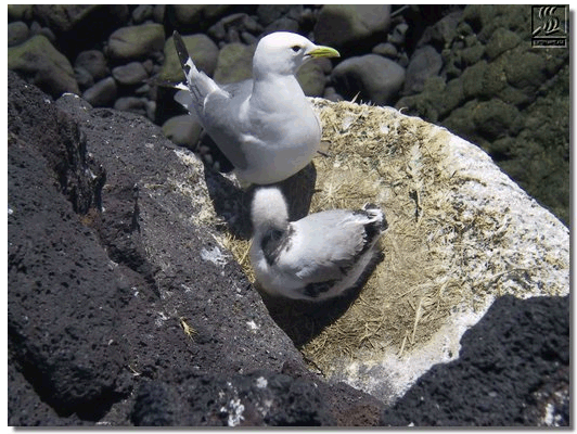
An island quickly colonized (first by marine algae, then vegetation from seeds in seabird droppings)
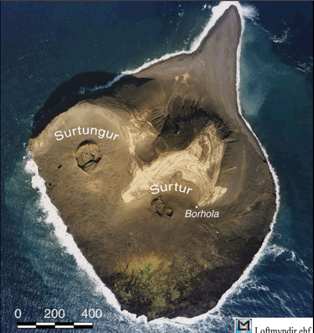
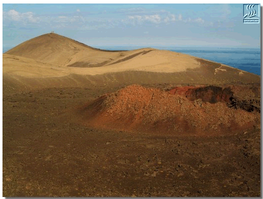
Current state, aerial view
Surtsey is the name of a giant from Icelandic mythology. Soon after, a new island emerged (all the Vestmannaeyjar islands were born from a single volcanic eruption). This time, the Icelandic parliament intervened and put a stop to it. It wasn’t up to volcanologists to name new geographical features—especially islands. They decided to name it after the young daughter of Haakon of Norway, to strengthen ties between the two countries. A committee was formed. Diplomatic missions traveled back and forth. A podium was built, speeches were composed in both languages, and media coverage was organized.
Then, just when everything was nearly ready for the celebration, in one night, the island disappeared...
If you look at the map of Iceland, you’ll see a road running along the southern coast, just below the Vatnajökull glacier. It’s bordered by black ash beaches. We had rented a Volkswagen and set off with my son and a young couple who might recognize themselves upon reading these lines. Since the road was deserted, my son—then seven years old—“drove” the whole way. Well, when I say “drive”—he was on my lap, and I handled the pedals and gears, while he held the steering wheel. The couple sat in the back. Seeing that the young woman was a bit anxious, he reassured them:
- It’s been a few months since I last held a steering wheel, but it’ll be fine—don’t worry.
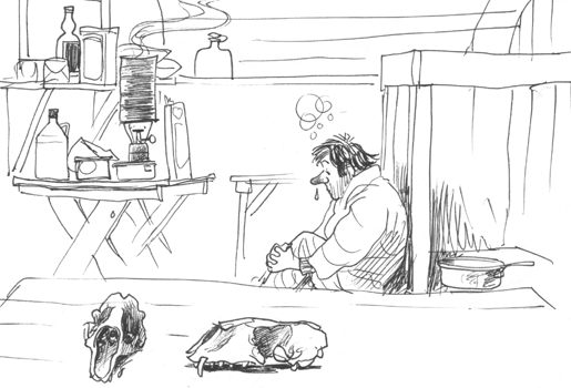
This is a self-portrait in a mountain refuge. In the foreground, a polar bear skull (which must have been stolen long ago by a tourist). I remember walking along one of these beaches, where large seabirds called Sqwass (I can’t recall the exact spelling) nested—quite aggressive. They were larger than gulls, beige in color. As we walked along this wide beach, there was a nest every twenty meters. It felt like we were in Hitchcock’s The Birds. Suddenly, the giant birds took off and attacked us, flying straight at us. I was taking photos while rolling backward with an “instamatic,” a disposable camera. Unfortunately, I lost a full-frame photo of one of the birds, whose wingspan covered the entire frame.
Well, where was I? Ah yes—this Antarctic story!
It reminds me of Vatnajökull. It’s a glacier located in a region where volcanic activity is widespread. At any sign of steam or hot gas, the ice is carved. Vatnajökull has spectacular vents. The hole in the photo looks like a volcanic vent. But here’s the question: is there volcanic activity in this part of Antarctica? And what could be the object partially covering this vent?
If anyone has an idea…