Animated image of cyclone Katrina
Katrina
September 22, 2005
January 12, 2006: remark about a meteorological singularity
**Animated Gif showing the movement of the cyclone on August 29, 2005 ( 5 megs ). **
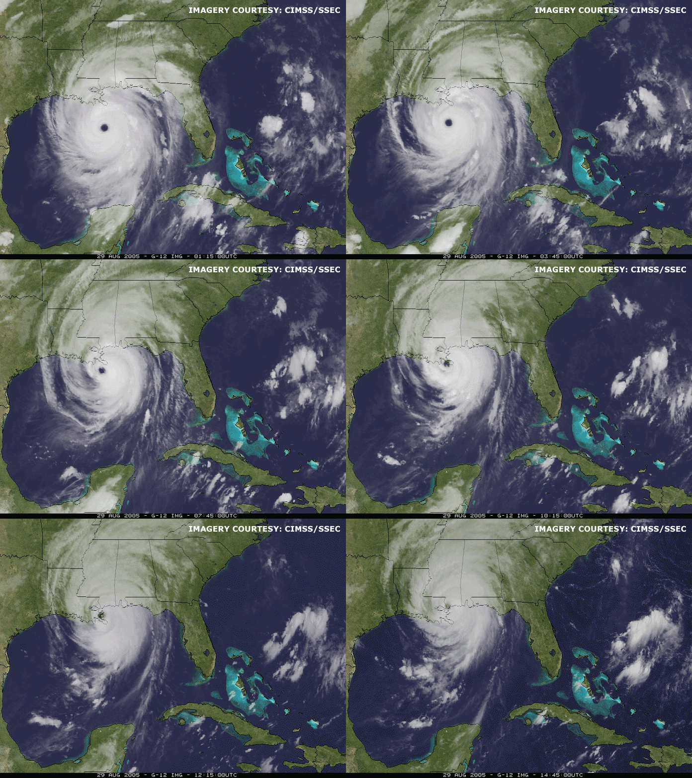
January 12, 2006. **Received from a reader the following email:
**
http://science.nasa.gov/headlines/y2006/09jan_electrichurricanes.htm?list158491
Hello,
I take the liberty of pointing out an interesting article concerning hurricane Katrina and the production of lightning:
In summary:
The largest hurricanes surprisingly do not produce lightning. Wind and rain yes, but they practically never "thunder" (phenomenon of thunder and lightning) .
And there, surprise: during three of the most powerful hurricanes of 2005, Rita, Katrina and Emily, lightning was produced, and even a lot of it. And researchers want to know why.
In reality, the electric fields above Emily were among the most powerful ever recorded by the detectors of the aircraft that flew over it (8kV per meter)
In fact, we know why most hurricanes do not produce lightning: a key ingredient is missing: vertical winds. In storm clouds, vertical winds force ice crystals and water droplets (called "hydrometeors") to collide and thus become charged. For reasons not well understood, positive electric charges accumulate on the smallest particles and negative ones stick to the largest. Winds and gravity separate these charged hydrometeors, producing an enormous electric field in the storm. This is the source of lightning.
Since hurricane winds are mainly horizontal, the agitation that leads to lightning normally does not occur.
Lightning has already been seen in hurricanes. In 1998, lightning was detected in the eye of hurricane Georges as it moved over the Caribbean island of Hispaniola. This lightning was probably formed by an updraft caused by the island's mountains.
Hurricanes are most likely to produce lightning when they make landfall, but for the "electric hurricanes" of 2005 there was only water..."
What struck me most is the last image of the article showing the charges detected above Emily: they form a straight line... it reminded me of the images that you put on your site where one sees these parallel bands...
My knowledge on the subject is very limited but it raises a few questions... one more piece to add to your file?
Cordially Jean-Christophe.
His email:
In the article excerpted from the Nasa site, see link above, one sees an infrared image obtained from the GOES 11 satellite of cyclone Emily, category 4 ( Rita and Katrina were category 5 ). For these three cyclones lightning was observed in the vicinity of the eye whereas the latter was located above the sea and consequently there were a priori no powerful updrafts, only intense swirling winds. Meteorologists know that the electrification of a cloud necessarily results from the presence of violent updrafts which cause an electrification of the carried particles, by friction, the different components not adopting the same upward speed according to their mass and their drag coefficient. Circular winds are never accompanied by an electrification of the cloud, when this movement takes place above flat terrain ( the sea ).
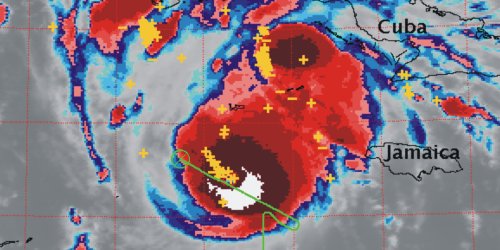
Lightning on Emily circulating above the sea, well off the south coast of the United States
The traces of the lightning are indicated by the plus and minus signs on the photo. In green is indicated the route followed by the ER-2 aircraft ( a variant of the U2 ), an apparatus that is used to track, from high altitude, meteorological phenomena.
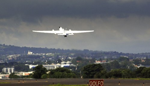
An ER-2 taking off
Below are the recordings of the electric fields measured on board the aircraft ( in X , Y , Z ) which testify to the violence of the discharges. One also notices that these discharges are aligned.
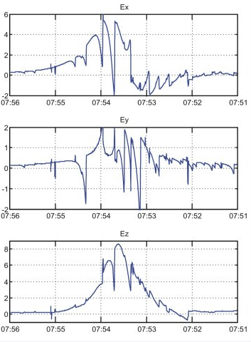
The significant electric voltages ( 8 kV/m ) recorded by the ER-2 aircraft during the discharges in the vicinity of Emily's eye
*This phenomenon, indubitable, remains totally incomprehensible within the framework of current knowledge in meteorology.
Return to Guide Return to Home page
**Number of visits to this page since January 12, 2006: ** ---
