Close-ups
September 3, 2005
1 - My house in Pertuis:
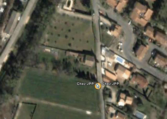
The Villa Jean-Christophe
2 - Area 51 D
First, a general view. It is crossed by the world's longest runway.

Area 51. General view. Clearly labeled "Groom Lake": a dry lake.
Have you ever seen runways that end straight into a hill? Neither have I (question mark). Zoom in on this corner.

The northern runway's end, over 8 kilometers long
Let's take a closer look.

Northern runway's end
Along this endless runway, 30 meters wide, the white central marking is clearly visible. We know that all secret tests ("Black Bird" SR-71, F-117A "Nighthawk") were conducted at night by those who called themselves the "Road Runners," the "runners of the runway." This name was also given to a desert bird that runs very fast across the ground. It was logical to mark the entire runway with a central line so pilots could orient themselves while taxiing. But why does this marking go "straight into the wall," when there are parking spots on the right? I'd wager this line indicates the entrance to hangars dug beneath the hill. The image corresponds to a photo taken from a thousand meters in altitude. I've had fun trying to reconstruct an oblique view of the site (which major powers have had for a long time). Let's recall that today, on a clear day, one can recognize a person's features from space.

Readers have asked me why it seems so easy to access images of this mythical Area 51. Indeed, its size appears relatively modest, except for the length of the runway—over 8 kilometers—hard to conceal. But what we see is only the tip of the iceberg. The rest lies deep underground. There are several reasons for this. Of course, discretion is key. But very quickly, the Americans wanted to protect their sensitive installations from nuclear strikes. Hence, installations were built at depths... incalculable. It's uncertain, except for the extraordinary 30-meter-diameter runway, that sensitive underground American installations have remained so concentrated in "notable locations." This is what's hinted at in Spielberg's TV series "Taken" (abductions), when one of the officials says, "We're moving elsewhere, while the gullible keep trying to uncover the secrets of this Area 51 with their binoculars."
September 8, 2005
Philippe Meobel suggests that the tarmac at the end of the runway (which allows planes to turn around to take off in a better direction relative to the wind) might be... an elevator shaft.
Area 51 in 1958 and 1968
September 6, 2005
Google Earth: Fake "3D"
When you use Google Earth, you have controls in the lower right corner that allow you to tilt the image and obtain a perspective view. You've probably wandered through rugged regions, like ravines or between mountains. You may have noticed that the software, in addition to reloading views at different resolutions, gradually enhances the terrain's relief. This can create the illusion that the massive Google Earth file corresponds to 3D data.
It's true that such data can exist, since modern satellites no longer take only vertical photos. By approaching their target obliquely, they can capture 3D images by playing with the movement. Paraphrasing Brassens, we could say today satellites cast "oblique glances" upon passersby. This has produced stunning images of Mars, for example. The same applies to Earth. This 3D capture of terrain is essential for planning trajectories... of cruise missiles, which often follow deep valleys to evade enemy radar.
Google Earth is fake 3D.
True 3D has such obvious strategic advantages that it wouldn't be distributed to just anyone. Therefore, Google employees took a 2D data base and "bumped up" the terrain with varying degrees of success. I know exactly how this is done, having created a similar tool 30 years ago in my CAD software Screen, which featured an "intelligent" modeler running at 2 megahertz on a 64 K machine, then at 4 MHz on a 128 K (Apple II, software Pangraphe, then Amstrad: Superpangraphe and Screen). I even appeared on TF1 presenting a film shot on an Apple, showing a village with hidden parts eliminated. We circled the object in a bird's-eye view, displaying monochrome images on a 190 by 300 pixel screen. This was at the very dawn of microcomputing. At the time, such "achievements" were reserved for "large systems." I should add that back then, a single moderately sophisticated color image, with an object seen through glass and a few reflections, required 10 hours of computation on a large system and cost 30,000 euros.
People wondered, "How could I make an Apple, clocked at 2 MHz, run so fast?" In fact, the images (which weighed 8 K!) were pre-calculated and stored in "virtual memory" (256 K, a first achieved by Apple). CDs didn't exist, of course, and thus I was presenting a preview of future digital imagery. I sold around 1,200 copies of Superpangraphe and Screen by mail in the early 1980s. The listing was thirty meters long. So I'm not completely ignorant in this field, even if I've fallen behind on modern programming tools.
Google Earth is a large file with 2D data. The team at the company improved the mess by giving "a few hammer blows" to certain pronounced reliefs. Let's say that starting from data where z = 0, the operation assigned elevations to points, with a single hammer blow corresponding to a "bell curve" (maximum value, plus standard deviation). If necessary, multiple hammer blows are applied in the same area. That's for hills. For certain objects, a homothety is applied. But sometimes the operator had only a very vague idea of the objects he was working on. Go take a look at the pyramids of Giza and examine them from a position "near the ground." You'll get this:
You have latitude and longitude to pinpoint the spot. Isn't that not quite the angle? Here, the Google guys were a bit too hasty.
There is a string of islands southwest of Marseille, one of which is splendid: Riou, rising over a hundred meters in height. I made my first climbs there in 1959 with Jean Lecomte. He was on this "deserted island" with his wife Lulu, climbing and... well.
Jean Lecomte
Jean-Claude and I, both twenty years old, had come to conduct a reconnaissance at an amphora site near the Imépériaux reef. We hit it off. Jean took us climbing a route facing the sea. We had no shoes, but our feet were so calloused that it worked perfectly.

Let's go to Google Earth and try to observe the island of Riou (which, in Phocaean times, served as a lighthouse for the ancient port. The carved post still stands at the top of the highest "tooth"). Here's what we get. First, a general view:
The Calanques of Marseille, general view

Seeing the shadows, we realize the coast and islands have pronounced relief. Maïre and Riou have impressive cliffs. Only the island of Plane, as its name suggests, is flat. Now let's move closer to Riou, near the water. Result:
The island of Riou and the island Maïre. "View taken from an altitude of 100 feet."
The "Google men" made a small effort for the coast. But what was my horror when I realized that the islands of Riou and Maïre had simply sunk into the sea!

Transmitted by Marie-Laure Michel, a recent photo of the island Maïre:
The island Maïre, near Marseille

Contrary to what appears in Google Earth, the island hasn't disappeared into the sea.
In Google Earth's database, there are landmark locations, like the Grand Canyon of Colorado. But if you wander through one of the canyons, you'll notice the water at the canyon's bottom is also "curved." All this because these data were reworked by interpolation, and this technique, while fast, doesn't handle breaks or sharp angles well (see the Sedan crater).
A small number of people manage to "add relief" to a 2D data base by injecting points whose geographic maps give elevations. The machine then interpolates the rest. Many places around the world have thus been processed. If needed, this treatment can be automated over large territories. But the system has its limits. The islands of Riou and Maïre, and many other "unimportant" places, were simply "forgotten," by humans or the machines serving them. One detail: some omissions may be... intentional.

Construction of a pseudo-relief by smoothing based on a few data points.
Returning to the far end of Area 51's runway, here's the image a reader sent me:
An impressive image, since beyond this dull plain, we can discern some relief.
Here's another view:

Since the runway is 30 meters wide, the bump at the end, indicated by the shadow, could hardly exceed 3 meters. Impossible to fit a hangar door there. Yet the runway's centerline marking leads directly to this rocky outcrop. If this were real, planes landing at night on this runway and following the dotted line would risk crashing into this "wall."
In fact, this image is outright FAKE.

Let's take the plan view of this terrain rise, shaded.
Plan projection of the terrain rise: one-hundredth of a mile: 18 meters

Now tilt the image.
Length measurement on the shaded bump
Same value. Yet, compared to the runway width—30 meters—this bump doesn't appear to measure 18 meters. I think image analysts have plenty of grain to grind, and in this presentation of this sector of Area 51, they simply provided plan views. The Google guys didn't bother "bumping" the images. Thus, this oblique view doesn't allow me to conclude there's nothing at the runway's end to house a door. At least, that's how I see it.

On the other hand, there are numerous sites across the American territory that offer striking "profile views." Some show what appear to be runways leading to fairly steep mountains. On one such runway, a reader even identified an airplane.
The Civet Cat site, pointed out by Julien Demonrot (the civet is a small feline, about the size of a cat)

When you descend near the ground, the relief becomes clear. Here, from 2,000 meters altitude, simulated.
We're approaching. It's definitely not "flat."
Here's a clear profile view. We can see the cliff. In blue, the Civet Canyon

Identified by the reader, an "airplane" emerging from an "underground bunker."

Elsewhere, readers report numerous geometric formations, more intriguing than the last.

This equilateral triangle containing 5 concentric circles is located not far from the Civet Canyon.

Notice that the geometric shapes remain regular regardless of the viewing angle. Yet the terrain is not flat.
The truth is that this shape isn't inscribed on the "ground," which is a "2D image of a terrain carved by canyons."

In conclusion, the Americans are simply taking us for fools...

Even with this "Civet" site, where the Google team clearly put in a lot of effort, interpolation leaves traces. Thus, when you look closely, planes must floor the throttle to climb the slope to reach their underground shelters. In conclusion, it's even questionable whether these runways, these shelters, actually exist. We're pedaling on low-quality virtual terrain.
One might wonder exactly what game we're playing. Some regions are "3D," others aren't. You'll notice that for the Sedan crater, the Google team seems to have made an effort. But when you move laterally, you see a huge patch that didn't appear in an old black-and-white photo.
Old photo of the Sedan site
Clearly visible on this image, the crater has blunt edges, which we'll see again in a recent photo.
What is this patch (or patches) on the following, more recent photo?

Sedan crater, later (when?)

The gray traces inside the crater: perhaps cloud shadows (?). The same view obtained "in perspective" via Google Earth:
What is this? Traces of water infiltration? (in the Nevada desert...)
A reader suggests "a buildup of dark dust." Another suggests cloud shadows. Hmm...

Here's a photo of the crater "today." But you don't see everything. You immediately notice the huge difference between the two "objects." In the Google Earth "perspective" image, the crater's edges are rounded, "smooth." There are no sharp edges. There's a bulge around the crater's perimeter that
does not exist

. This is a false perspective, the result of overlaying a texture onto a 3D surface "fabricated by interpolation."
Sedan crater, today
You see that the Google Earth tool offers disconcerting aspects. Some wonder how it's possible that Americans allow the public access to all parts of the world, even the most sensitive ones, like the famous Area 51.
It feels like the 3D relief effect doesn't match reality. If you zoom in on certain regions of the globe (like the Marseille coast, for example), you'll see that at times the sea isn't flat at all. As if the "surface bumpers" at Google, while artificially creating relief, somewhat randomly caught a bit of ocean. Moreover, the Marseille coast has relief, but the nearby island of Maïre, and the 4-kilometer-away island of Riou, seem to have been... forgotten.
The conclusion seems to be that everything coming from Google Earth must be taken with caution. Near the Civet Canyon, what does this 1.3-kilometer-wide triangular formation with concentric circles signify? Does it really exist? Could these formations, like many others, be there to draw attention? For example, these bunker exits opening onto runways? How come Area 51 images are completely devoid of relief, apparently?

The conclusion is that the perspective images provided by Google Earth are in no way reliable.
They practically mean nothing.
Transmitted by Eric Dezoete, images from 1982 showing an Air Force tunneling vehicle. This type of vehicle gives an idea of the underground networks that must exist beneath these surface installations.
Air Force tunneling vehicle, 1982
The same, viewed from the front
3 - The Nevada Underground Nuclear Test Site
Compared to Area 51, this is really "next door":

On the left: the underground nuclear test site. At the top right: Area 51

Thierry provides the answer: 20 km.
The underground nuclear test site, general view.
The American underground nuclear test site in Nevada. At the top: the "Sedan" crater

An aerial view of this "nuclear scar":
The Nevada desert has the scar
You can zoom in on these collapse pits corresponding to megatonne-scale tests. By rotating the image, I achieved a more readable shading effect.

Collapse pits after underground nuclear tests
Close-up on access tunnels, dug after the test to inspect the chamber containing radioactive debris. Let's briefly recall the layout of an underground nuclear explosion. It's conducted in loose ground (the Nevada site's soil is alluvial). The compressibility of the terrain absorbs the shockwave's energy. The ground rises, then falls. At the bottom, the extremely hot gases remain trapped in a spherical cavity. The high temperature vitrifies the solid material. Then the gases cool. Pressure in the cavity drops. Its ceiling collapses, and this collapse propagates progressively up to the surface, forming these kinds of craters.
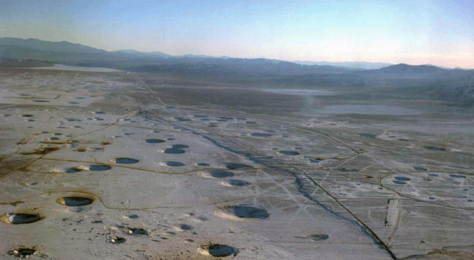
The depths of the above tests must be around 1,000 to 1,500 meters. During the failed In Ecker test in the early 1960s in the Sahara, military engineers from the Polytechnic, vaguely aware that Americans continued underground testing, thought they needed to operate in strong rock. They chose a granite mountain, digging a spiral access tunnel. They based their calculations on sophisticated models, which turned out to be wrong. Pressure blew the reinforced concrete plug. The Minister of Defense, Pierre Messmer, was irradiated, as was Gaston Palewski, who later died of leukemia. The gases burst out, creating a massive pinkish cloud. At the firing post, where no one had worn heat-resistant suits, panic ensued. Officials rushed into their cars to leave as fast as possible. Unfortunately, their drivers, trying to help, turned on... the air conditioning!
Oblique view of the craters from the Nevada underground nuclear tests, taken from an aircraft:

The collapse craters from Nevada's underground nuclear tests
Zoom in on the "Sedan" crater. The alleged power was 100 kilotons (8 times Hiroshima). The Americans claimed this test, from the early 1960s, was designed to demonstrate the effectiveness of nuclear weapons as earth-moving tools. For this, the charge had to be close enough to the surface for the explosion to break through. There's a particularly impressive film showing the ground lifting immediately after the explosion. Afterwards, there were significant releases of radioactive debris. They didn't persist. But it was predictable. Who would be crazy enough to use nuclear weapons to dig canals? In my book "UFOs and American Secret Weapons," I offer another interpretation of this event.
The Sedan nuclear test crater, visible from space.
A close-up of the Sedan crater, taken from an aircraft, before the central tower was installed:

See also other images of this crater,
higher up.
5 - The aircraft graveyard near Tucson, Arizona. Images transmitted by David Meusnier:
Above: General view of the Tucson aircraft graveyard, Arizona

Above: Large military transport aircraft and combat helicopters
Above: B-52 octo-jet aircraft

A reader informs me that the B-52s at the center had their wings broken, not dismantled, as part of disarmament agreements with the Soviets or former Soviets.

October 15, 2005:
Noted by a reader, Vincent Vaillant: an exit opening for vehicles in Area 51.
Here's the dive into the site:

Area 51, general view. The location where Vincent Vaillant identified the exit for vehicles emerging from underground installations, near the main runway.

On the right, the main runway, 30 meters wide, provides scale. The tarmac measures 90 m by 90 m.

At the bottom left, the opening allowing vehicles 10 to 15 meters in wingspan to emerge from underground installations.
Number of views between September 3 and September 15, 2005: 15,395
Number of views since September 15, 2005:
Return to "Dive into Google Earth"